Severe Thunderstorm Warning issued August 11 at 8:23AM EDT until August 11 at 9:00AM EDT by NWS Wilmington OH (details ...)
At 823 AM EDT, a severe thunderstorm was located near St. Henry, moving southeast at 40 mph. HAZARD...60 mph wind gusts. SOURCE...Radar indicated. IMPACT...Expect damage to trees and power lines. Locations impacted include... Coldwater, Versailles, St. Henry, Bradford, Webster, Gettysburg, Osgood, Chickasaw, Burkettsville, North Star, Montezuma, New Weston, Yorkshire, Darke County Airport, Maria Stein, Brock, State Route 47 at US Route 127, Eldora Speedway, Carthagena, and Willowdell.
Severe Thunderstorm Warning issued August 11 at 8:18AM EDT until August 11 at 9:00AM EDT by NWS Wilmington OH (details ...)
At 817 AM EDT, severe thunderstorms were located along a line extending from near Union City to 7 miles southeast of Muncie, moving southeast at 40 mph. HAZARD...60 mph wind gusts. SOURCE...Radar indicated. IMPACT...Expect damage to trees and power lines. Locations impacted include... Richmond, Greenville, Centerville, Arcanum, Hagerstown, Union City, Fort Recovery, Ansonia, New Madison, Fountain City, Dublin, Franklin, Wayne Lakes, Gettysburg, Greens Fork, Pitsburg, Bethel, Hollansburg, Rossburg, and Palestine. This includes I-70 in Indiana between mile markers 134 and 148.
Flood Watch issued August 11 at 4:12AM EDT until August 12 at 8:00AM EDT by NWS Wilmington OH (details ...)
* WHAT...Flash flooding caused by excessive rainfall continues to be possible. * WHERE...Portions of Indiana, including the following counties, Dearborn, Fayette, Franklin, Union and Wayne, Kentucky, including the following counties, Boone, Bracken, Campbell, Kenton, Lewis, Mason, Pendleton and Robertson, and Ohio, including the following counties, Adams, Auglaize, Brown, Butler, Champaign, Clark, Clermont, Clinton, Darke, Delaware, Fairfield, Fayette, Franklin, Greene, Hamilton, Hardin, Highland, Hocking, Licking, Logan, Madison, Mercer, Miami, Montgomery, Pickaway, Pike, Preble, Ross, Scioto, Shelby, Union and Warren. * WHEN...Through Wednesday morning. * IMPACTS...Excessive runoff may result in flooding of rivers, creeks, streams, and other low-lying and flood-prone locations. * ADDITIONAL DETAILS... - Several rounds of thunderstorms are expected into Wednesday morning. Locally heavy rainfall can be expected with the potential for storms to repeatedly track over the same locations. This will result in the potential for flash flooding.
Severe Thunderstorm Warning issued August 11 at 8:34AM EDT until August 11 at 9:15AM EDT by NWS Wilmington OH (details ...)
At 834 AM EDT, a severe thunderstorm was located over Fort Loramie, moving east at 45 mph. HAZARD...60 mph wind gusts. SOURCE...Radar indicated. IMPACT...Expect damage to trees and power lines. Locations impacted include... Troy, Sidney, Piqua, New Bremen, Minster, Covington, Newport, Bradford, Anna, Fort Loramie, Jackson Center, Pleasant Hill, Botkins, New Knoxville, Hardin, Russia, Laura, Fletcher, Port Jefferson, and Casstown. This includes I-75 in Ohio between mile markers 71 and 106.
Special Weather Statement issued August 11 at 8:34AM EDT by NWS Wilmington OH (details ...)
At 834 AM EDT, a rapidly developing thunderstorm was located near Chippewa Park, moving east at 45 mph. HAZARD...Wind gusts up to 50 mph and half inch hail. SOURCE...Radar indicated. IMPACT...Gusty winds could knock down tree limbs and blow around unsecured objects. Hail may cause minor damage to vegetation. Locations impacted include... Bellefontaine, Kenton, Richwood, Russells Point, Lakeview, Alger, Belle Center, West Mansfield, Chippewa Park, Northwood, Blanchard, Roundhead, Mount Victory, Rushsylvania, Mcguffey, Huntsville, Ridgeway, Zanesfield, Raymond, and New Jerusalem. If outdoors, consider seeking shelter inside a sturdy building. To report hazardous weather conditions, go to our website at weather.gov/iln and submit your report via social media, when you can do so safely.
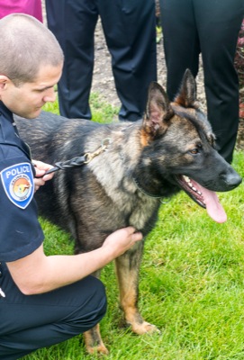
K-9 Peng the newest officer with the Celina Police Department
By William Kincaid
CELINA - The police department's newest officer, a pointy-eared, long-tongued K-9, comes from Germany and has taken to the streets to sniff out drugs, track down bad guys, find missing residents and battle crime in Celina.
Peng, a 20-month-old German shepherd, arrived in Celina about three months ago and had his first day on the job April 24 after completing training at the Von Der Haus Gill Canine Academy near Wapakoneta. [More]
NEW BREMEN - Versailles' only hit of the game could not have been more timely.
Sarah Gigandet lashed a two-out, two-strike pitch just beyond the reach of New Bremen's left fielder, scoring two unearned runs to give the Tigers a 2-1 victory and a share of the Midwest Athletic Conference softball title Tuesday on the Cardinal diamond. [More]
CELINA - City residents didn't just sweep out the cobwebs from their homes this spring-cleaning season, they must have unloaded their kitchen sinks, too, as a massive amount of trash was picked up in the last few weeks.
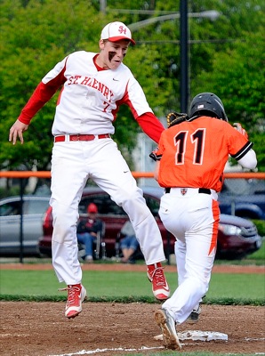
COLDWATER - Two big home runs by Coldwater earlier in the game were buoyed by a standout pitching performance from Jack Hemmelgarn, and the Cavaliers beat St. Henry 9-1 to claim a share of the MAC baseball title on Senior Day at Veterans Field.
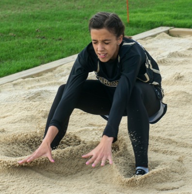
FORT RECOVERY - The Midwest Athletic Conference track meet got underway Tuesday night as finals were contested in nine field events and the two 4x8000-meter relays.