Special Weather Statement issued May 1 at 8:06PM EDT by NWS Wilmington OH (details ...)
At 806 PM EDT, a strong thunderstorm was located over Monroe, moving northeast at 35 mph. HAZARD...Wind gusts up to 45 mph and pea size hail. SOURCE...Radar indicated. IMPACT...Gusty winds could knock down tree limbs and blow around unsecured objects. Hail may cause minor damage to vegetation. This storm will remain over mainly rural areas of northwestern Mercer County. If outdoors, consider seeking shelter inside a sturdy building. To report hazardous weather conditions, go to our website at weather.gov/iln and submit your report via social media, when you can do so safely.
Thursday, September 28th, 2017
Photo by William Kincaid/The Daily Standard
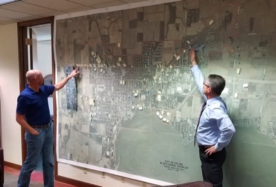
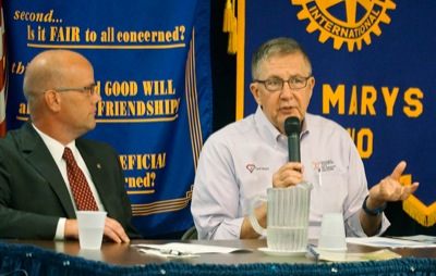
Celina City Safety Service Director Tom Hitchcock, left, and mayor Jeff Hazel at a committee meeting this week point out areas that golf cart drivers cannot legally drive beyond due to their ban from roadways with speed limits faster than 25 mph.