The Daily Standard
Pictures Archive
Menu
▼
Home
Subscribe
E-Edition
Archives
▼
Archives
Obituary Archives
Photo Albums
Podcasts
▼
Podcasts
Video
Classifieds
▼
Classifieds
Public Notices
Weather
Sports
More
▼
Contacts
Advertising
Subscription Payment
Community Pictures
Historical Maps
Forms
Locations
Elections
Today
73°
Today
73°
slight
chance
slight
chance
58°
58°
slight
chance
Tomorrow
60°
Tomorrow
60°
40°
40°
chance
Saturday, April 7th, 2018
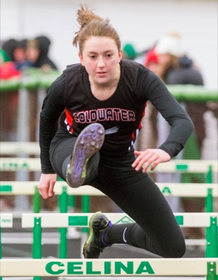
Photo by Mark Pummell/The Daily Standard
Coldwater's Jessica Break clears a hurdle during Friday's Celina Relays.
Related online story:
Snow doesn't slow Bulldogs
CELINA - Celina track and field coach Eric Wagner gazed into the night sky after he dismissed his team from their post-meet huddle in the infield of Varsity Track. [
More
]
Purchase a print of this photo.
Archive of April 7th, 2018
Buy this E-Edition
Additional pictures on this date
<!--Unsupported browser-->
Copyright © 2026 Standard Printing Co. All Rights Reserved