Severe Thunderstorm Warning issued August 10 at 11:08PM EDT until August 10 at 11:15PM EDT by NWS Wilmington OH (details ...)
The storm which prompted the warning has weakened below severe limits and has exited the warned area. Therefore, the warning will be allowed to expire.
A Severe Thunderstorm Watch remains in effect until 200 AM EDT for west central Ohio.
Please report previous wind damage or hail to the National Weather Service by going to our website at weather.gov/iln and submitting your report via social media.
Flood Advisory issued August 10 at 10:45PM EDT until August 11 at 1:45AM EDT by NWS Wilmington OH (details ...)
* WHAT...Flooding caused by excessive rainfall is expected.
* WHERE...Northwestern Auglaize County in west central Ohio... Northern Mercer County in west central Ohio...
* WHEN...Until 145 AM EDT.
* IMPACTS...Minor flooding in low-lying and poor drainage areas.
* ADDITIONAL DETAILS... - At 1045 PM EDT, radar indicated heavy rain due to thunderstorms. Minor flooding is ongoing or expected to begin shortly in the advisory area. Between 0.5 and 2 inches of rain have fallen. Additional rainfall amounts up to 2 inches are possible. - Some locations that may experience flooding include... Celina, St. Marys, Rockford, Moulton, Mendon, Buckland, Neptune, Tama, State Route 116 at State Route 197, Kossuth and Chattanooga.
Severe Thunderstorm Watch issued August 10 at 7:26PM EDT until August 11 at 2:00AM EDT by NWS Wilmington OH (details ...)
THE NATIONAL WEATHER SERVICE HAS ISSUED SEVERE THUNDERSTORM WATCH 560 IN EFFECT UNTIL 2 AM EDT TUESDAY FOR THE FOLLOWING AREAS
IN INDIANA THIS WATCH INCLUDES 1 COUNTY
IN EAST CENTRAL INDIANA
WAYNE
IN OHIO THIS WATCH INCLUDES 21 COUNTIES
IN CENTRAL OHIO
DELAWARE FAIRFIELD FAYETTE FRANKLIN HOCKING LICKING MADISON PICKAWAY UNION
IN WEST CENTRAL OHIO
AUGLAIZE CHAMPAIGN CLARK DARKE GREENE HARDIN LOGAN MERCER MIAMI MONTGOMERY PREBLE SHELBY
THIS INCLUDES THE CITIES OF ADA, BEAVERCREEK, BELLEFONTAINE, CAMDEN, CELINA, CIRCLEVILLE, COLDWATER, DELAWARE, DOWNTOWN COLUMBUS, DOWNTOWN DAYTON, EATON, FAIRBORN, GREENVILLE, KENTON, KETTERING, LANCASTER, LOGAN, LONDON, MARYSVILLE, MINSTER, NEW BREMEN, NEWARK, PICKERINGTON, PIQUA, PLAIN CITY, RICHMOND, SIDNEY, SPRINGFIELD, ST. MARYS, TIPP CITY, TROY, URBANA, WAPAKONETA, WASHINGTON COURT HOUSE, WEST JEFFERSON, AND XENIA.
Flood Watch issued August 10 at 1:04PM EDT until August 12 at 8:00AM EDT by NWS Wilmington OH (details ...)
* WHAT...Flash flooding caused by excessive rainfall is possible.
* WHERE...Portions of Indiana, including the following counties, Dearborn, Fayette, Franklin, Union and Wayne, Kentucky, including the following counties, Boone, Bracken, Campbell, Kenton, Lewis, Mason, Pendleton and Robertson, and Ohio, including the following counties, Adams, Auglaize, Brown, Butler, Champaign, Clark, Clermont, Clinton, Darke, Delaware, Fairfield, Fayette, Franklin, Greene, Hamilton, Hardin, Highland, Hocking, Licking, Logan, Madison, Mercer, Miami, Montgomery, Pickaway, Pike, Preble, Ross, Scioto, Shelby, Union and Warren.
* WHEN...Through Wednesday morning.
* IMPACTS...Excessive runoff may result in flooding of rivers, creeks, streams, and other low-lying and flood-prone locations.
* ADDITIONAL DETAILS... - Several rounds of thunderstorms are expected through Tuesday night. Locally heavy rainfall can be expected with the potential for storms to repeatedly track over the same locations. This will result in the potential for flash flooding.
Flash Flood Warning issued August 10 at 10:30PM EDT until August 11 at 1:30AM EDT by NWS Wilmington OH (details ...)
FFWILN
The National Weather Service in Wilmington has issued a
* Flash Flood Warning for... Northwestern Union County in central Ohio... Northeastern Auglaize County in west central Ohio... Southern Hardin County in west central Ohio... Logan County in west central Ohio... Northeastern Shelby County in west central Ohio...
* Until 130 AM EDT.
* At 1030 PM EDT, radar indicated thunderstorms producing heavy rain across the warned area. Between 1 and 2.5 inches of rain have fallen. Additional rainfall amounts up to 2.5 inches are possible. Flash flooding is ongoing or expected to begin shortly.
HAZARD...Flash flooding caused by thunderstorms.
SOURCE...Radar indicated.
IMPACT...Flash flooding of small creeks and streams, urban areas, highways, streets and underpasses as well as other poor drainage and low-lying areas.
* Some locations that may experience flash flooding include... Bellefontaine, Kenton, West Liberty, Russells Point, De Graff, Lakeview, Waynesfield, Belle Center, West Mansfield, Chippewa Park, Northwood, Roundhead, Quincy, Mount Victory, Rushsylvania, Huntsville, Ridgeway, Valley Hi, Zanesfield and Big Springs.
69° 69° chance Tue 82° Tue 82° likely 66° 66° likely Wed 82° Wed 82° chance
Monday, July 23rd, 2018
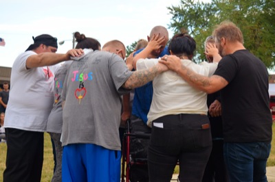
Community members gather to fight addiction, support victims
By Tom Stankard
ST. MARYS - It takes faith and a united community to fight opioid addiction, a crowd of more than 80 people learned at Sunday's Night of Hope: A Concert against Heroin.
Rain and gloomy weather gave way to partly cloudy skies as people gathered at Memorial Park to enjoy live music and speeches given by those who have gone through addiction and those who are trying to fight it. [More]
Obituaries on July 23rd, 2018
Edward R. Davis, age 94 of Celina, Ohio passed away at 3:00 a.m. on Saturday Ju [More]
Danna A. Noggler, age 66, of Fort Recovery, Ohio, died July 21, 2018, at his home. [More]
Charles "Picket" B. Otting, age 86 Little Rock, MS, passed away of natural caus [More]
Local pictures on July 23rd, 2018
Subscriber stories on July 23rd, 2018
Application by air gets the job done faster
CELINA - Small airplanes darting just above farm fields have become a common sight in the area.
Mercer Landmark agronomist Eldon Sell said farmers utilize crop dusters to spray mostly fungicide on maturing crops, and their use is beginning to increase in popularity.
2018 State ACME Baseball Tournament
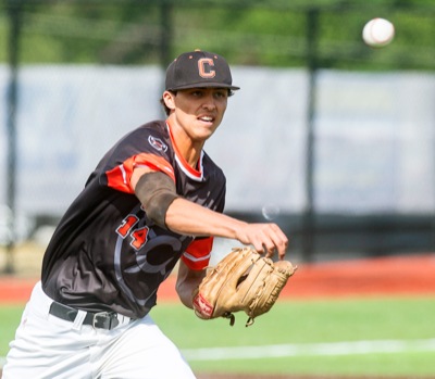
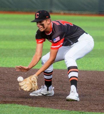
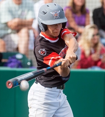
Coldwater strands 17 runners on base in 12-inning tournament loss to Bryan
DEFIANCE - As well as Coldwater played on Sunday, the chances that slipped through proved to be costly.
The Cavaliers left the winning run stranded
Compiled by Colin Foster and Gary R. Rasberry
Grand Lake dropped to last place in the Great Lakes Summer Collegiate League Northern Division after extending its losing streak to seven straight with a pair of 7-2 losses to the Muskegon Clippers in a Sunday doubleheader at Marsh Field.
Tri-County Swimming Championship
Compiled by Gary R. Rasberry
The rain held off long enough for St. Marys to have a dominating day en route to cruising to a big victory at the Tri-County Swimming Championship held on Saturday at Bryson Pool in Celina.