Flood Watch issued August 15 at 10:25PM EDT until August 16 at 8:00AM EDT by NWS Wilmington OH (details ...)
* WHAT...Flash flooding caused by excessive rainfall continues to be possible.
* WHERE...Portions of Indiana, including the following counties, Fayette, Franklin, Union and Wayne and Ohio, including the following counties, Adams, Auglaize, Butler, Champaign, Clark, Clinton, Darke, Delaware, Fairfield, Fayette, Franklin, Greene, Hardin, Highland, Hocking, Licking, Logan, Madison, Mercer, Miami, Montgomery, Pickaway, Pike, Preble, Ross, Scioto, Shelby, Union and Warren.
* WHEN...Until 8 AM EDT Sunday.
* IMPACTS...Excessive runoff may result in flooding of rivers, creeks, streams, and other low-lying and flood-prone locations.
* ADDITIONAL DETAILS... - Additional rounds of showers and thunderstorms are possible tonight. Locally heavy rainfall may result in flash flooding.
70° 70° chance Sun 82° Sun 82° slight chance 68° 68° chance Mon 77° Mon 77° chance
Friday, May 14th, 2021
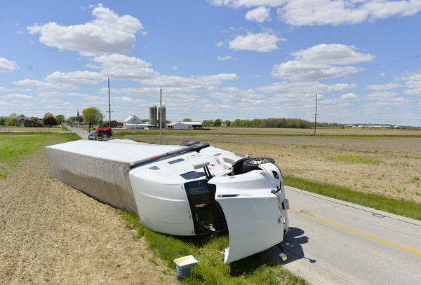
Scrambled eggs
Photo by Dan Melograna/The Daily Standard

The Coldwater Fire Department and Mercer County Sheriff's Office responded to an overturned semitrailer at the intersection of Burkettsville-St. Henry and Philothea roads at about 1:51 p.m. Thursday. The truck reportedly was eastbound on Philothea Road hauling eggs when it overturned into a ditch and farm field. According to Chief Deputy Gery Thobe, the driver, who is reportedly from California, took the turn too fast. There were no injuries. The road was closed for hours Thursday so crews could unload the semi and repair damage to the road. The road has reopened.


Additional pictures on this date