Severe Thunderstorm Watch issued May 19 at 4:39PM EDT until May 19 at 10:00PM EDT by NWS Wilmington OH (details ...)
THE NATIONAL WEATHER SERVICE HAS ISSUED SEVERE THUNDERSTORM WATCH 231 IN EFFECT UNTIL 10 PM EDT THIS EVENING FOR THE FOLLOWING AREAS
IN INDIANA THIS WATCH INCLUDES 6 COUNTIES
IN EAST CENTRAL INDIANA
FAYETTE UNION WAYNE
IN SOUTHEAST INDIANA
DEARBORN FRANKLIN RIPLEY
IN OHIO THIS WATCH INCLUDES 16 COUNTIES
IN CENTRAL OHIO
UNION
IN SOUTHWEST OHIO
BUTLER HAMILTON WARREN
IN WEST CENTRAL OHIO
AUGLAIZE CHAMPAIGN CLARK DARKE GREENE HARDIN LOGAN MERCER MIAMI MONTGOMERY PREBLE SHELBY
THIS INCLUDES THE CITIES OF ADA, AURORA, BATESVILLE, BEAVERCREEK, BELLEFONTAINE, BRIGHT, BROOKVILLE, CAMDEN, CELINA, COLDWATER, CONNERSVILLE, DILLSBORO, DOWNTOWN CINCINNATI, DOWNTOWN DAYTON, EATON, FAIRBORN, FAIRFIELD, FRANKLIN, GREENDALE, GREENVILLE, HAMILTON, HIDDEN VALLEY, KENTON, KETTERING, LANDEN, LAWRENCEBURG, LEBANON, LIBERTY, MARYSVILLE, MASON, MIDDLETOWN, MILAN, MINSTER, NEW BREMEN, OSGOOD, OXFORD, PIQUA, RICHMOND, SIDNEY, SPRINGBORO, SPRINGFIELD, ST. MARYS, TIPP CITY, TROY, URBANA, VERSAILLES, WAPAKONETA, WEST COLLEGE CORNER, AND XENIA.
Special Weather Statement issued May 19 at 6:40PM EDT by NWS Wilmington OH (details ...)
At 640 PM EDT, strong thunderstorms were located along a line extending from near Ada to Jackson Center, moving northeast at 50 mph.
HAZARD...Wind gusts up to 45 mph, pea size hail, and very heavy rain.
SOURCE...Radar indicated.
IMPACT...Gusty winds could knock down tree limbs and blow around unsecured objects. Hail may cause minor damage to vegetation. Visibility will be poor and hydroplaning is possible.
Locations impacted include... Sidney, Bellefontaine, Kenton, Ada, Jackson Center, Forest, Russells Point, De Graff, Lakeview, Dunkirk, Alger, Waynesfield, Belle Center, West Mansfield, Chippewa Park, Northwood, Blanchard, Roundhead, Quincy, and Mount Victory.
This includes I-75 in Ohio between mile markers 92 and 98.
If outdoors, consider seeking shelter inside a sturdy building.
Motorists should slow down and use extra caution.
A Severe Thunderstorm Watch remains in effect until 1000 PM EDT for central and west central Ohio.
To report hazardous weather conditions, go to our website at weather.gov/iln and submit your report via social media, when you can do so safely.
Today 88° Today 88° slight chance chance 60° 60° likely Tomorrow 68° Tomorrow 68° chance 47° 47°
Monday, April 19th, 2021
A new program targets Marshallese students
By Sydney Albert
CELINA - A new mentorship program based out of Celina High School aims to create positive experiences and build confidence in Marshallese students by matching them with adult members of the local Marshallese community.
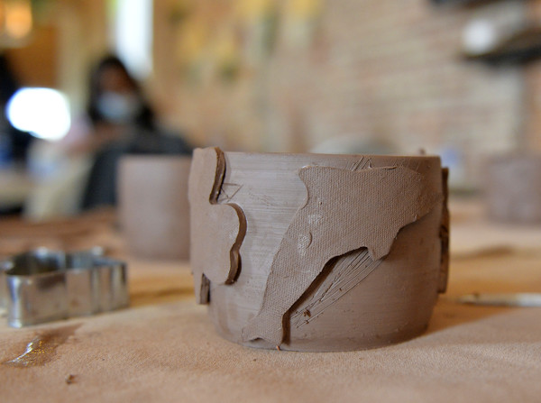
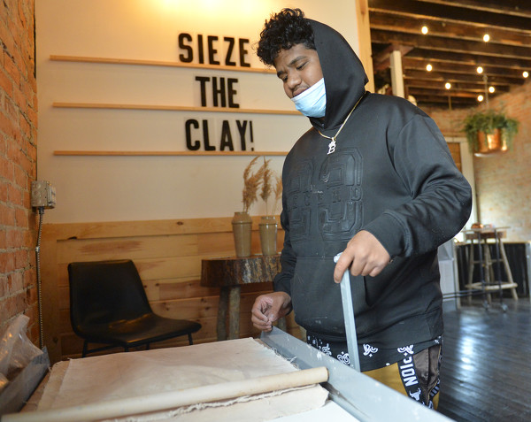
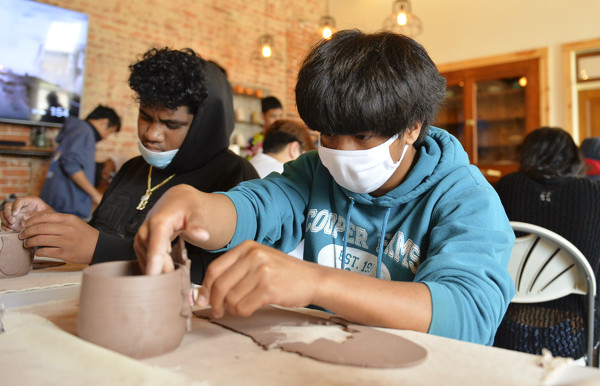
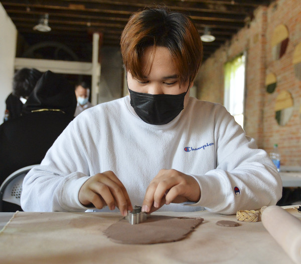
Recently at the Nite Owl Studio in downtown Celina, members of the Marshallese Mentorship Program gathered to make clay pots under the direction of Braelen Bader, an English language tutor at Celina High School and owner of the studio. [More]
Obituaries on April 19th, 2021
Norman Joseph Schlecty, 87 of Yorkshire, Ohio, passed away on Friday April 16, [More]
Charles "Chuck" J. Overman, 64, of Fort Recovery, Ohio, passed away peacefully [More]
Victor R. Eyink, age 75 of Coldwater, Ohio, passed away peacefully surrounded b [More]
M. Helen Schwieterman, 85, of Delphos, passed away Saturday April 17, 2021, at [More]
Mary Ann (Knapke) Klosterman, age 96, of Montezuma died Friday, April 16, 2021 [More]
Winona Marie Brown, 90, of New Knoxville, died at 4:30 P.M. Saturday, April 10, [More]
Local pictures on April 19th, 2021
Subscriber stories on April 19th, 2021
Weekend Roundup
Minster boys capture home meet; West Liberty-Salem edge Minster girls
Compiled by Gary R. Rasberry
Minster played host to teams from Ohio and Indiana at the annual Minster Memorial track and field invitational on Saturday at Memorial Field.