Severe Thunderstorm Warning issued August 10 at 9:49PM EDT until August 10 at 10:30PM EDT by NWS Wilmington OH (details ...)
SVRILN The National Weather Service in Wilmington has issued a * Severe Thunderstorm Warning for... Northeastern Shelby County in west central Ohio... Southern Auglaize County in west central Ohio... Central Mercer County in west central Ohio... * Until 1030 PM EDT. * At 948 PM EDT, a severe thunderstorm was located near St. Marys, moving southeast at 45 mph. HAZARD...60 mph wind gusts and quarter size hail. SOURCE...Radar indicated. IMPACT...Minor hail damage to vehicles is possible. Expect wind damage to trees and power lines. * Locations impacted include... Celina, Wapakoneta, St. Marys, Coldwater, New Bremen, Minster, Anna, Jackson Center, Botkins, New Knoxville, Moulton, Wabash, Port Jefferson, Kettlersville, Montezuma, Fryburg, Montra, Tama, Neptune, and Maplewood. This includes I-75 in Ohio between mile markers 96 and 112.
Severe Thunderstorm Warning issued August 10 at 9:29PM EDT until August 10 at 10:15PM EDT by NWS Wilmington OH (details ...)
SVRILN The National Weather Service in Wilmington has issued a * Severe Thunderstorm Warning for... Northwestern Auglaize County in west central Ohio... Northern Mercer County in west central Ohio... * Until 1015 PM EDT. * At 929 PM EDT, a severe thunderstorm was located near Ohio City, moving east at 35 mph. HAZARD...60 mph wind gusts and quarter size hail. SOURCE...Radar indicated. IMPACT...Minor hail damage to vehicles is possible. Expect wind damage to trees and power lines. * Locations impacted include... Wapakoneta, Fort Shawnee, Cridersville, Rockford, Mendon, Buckland, Uniopolis, Chattanooga, Kossuth, Tama, St. Johns, Neptune, and State Route 116 at State Route 197. This includes I-75 in Ohio between mile markers 111 and 118.
Severe Thunderstorm Watch issued August 10 at 7:26PM EDT until August 11 at 2:00AM EDT by NWS Wilmington OH (details ...)
THE NATIONAL WEATHER SERVICE HAS ISSUED SEVERE THUNDERSTORM WATCH 560 IN EFFECT UNTIL 2 AM EDT TUESDAY FOR THE FOLLOWING AREAS IN INDIANA THIS WATCH INCLUDES 1 COUNTY IN EAST CENTRAL INDIANA WAYNE IN OHIO THIS WATCH INCLUDES 21 COUNTIES IN CENTRAL OHIO DELAWARE FAIRFIELD FAYETTE FRANKLIN HOCKING LICKING MADISON PICKAWAY UNION IN WEST CENTRAL OHIO AUGLAIZE CHAMPAIGN CLARK DARKE GREENE HARDIN LOGAN MERCER MIAMI MONTGOMERY PREBLE SHELBY THIS INCLUDES THE CITIES OF ADA, BEAVERCREEK, BELLEFONTAINE, CAMDEN, CELINA, CIRCLEVILLE, COLDWATER, DELAWARE, DOWNTOWN COLUMBUS, DOWNTOWN DAYTON, EATON, FAIRBORN, GREENVILLE, KENTON, KETTERING, LANCASTER, LOGAN, LONDON, MARYSVILLE, MINSTER, NEW BREMEN, NEWARK, PICKERINGTON, PIQUA, PLAIN CITY, RICHMOND, SIDNEY, SPRINGFIELD, ST. MARYS, TIPP CITY, TROY, URBANA, WAPAKONETA, WASHINGTON COURT HOUSE, WEST JEFFERSON, AND XENIA.
Flood Watch issued August 10 at 1:04PM EDT until August 12 at 8:00AM EDT by NWS Wilmington OH (details ...)
* WHAT...Flash flooding caused by excessive rainfall is possible. * WHERE...Portions of Indiana, including the following counties, Dearborn, Fayette, Franklin, Union and Wayne, Kentucky, including the following counties, Boone, Bracken, Campbell, Kenton, Lewis, Mason, Pendleton and Robertson, and Ohio, including the following counties, Adams, Auglaize, Brown, Butler, Champaign, Clark, Clermont, Clinton, Darke, Delaware, Fairfield, Fayette, Franklin, Greene, Hamilton, Hardin, Highland, Hocking, Licking, Logan, Madison, Mercer, Miami, Montgomery, Pickaway, Pike, Preble, Ross, Scioto, Shelby, Union and Warren. * WHEN...Through Wednesday morning. * IMPACTS...Excessive runoff may result in flooding of rivers, creeks, streams, and other low-lying and flood-prone locations. * ADDITIONAL DETAILS... - Several rounds of thunderstorms are expected through Tuesday night. Locally heavy rainfall can be expected with the potential for storms to repeatedly track over the same locations. This will result in the potential for flash flooding.
Three Coldwater school employees placed on administrative leaves
By Eric Adams
COLDWATER - More than 50 parents, students and school employees attended the school board meeting Tuesday night as a demonstration of support for three high school employees who recently were placed on administrative leave.
Marge Hoops, Carole Huber and Elaine Schwendeman all received an undisclosed period of leave on March 4 for alleged timecard violations. Additional details of the incidents have not yet surfaced. [More]
The Grand Lake Mariners will no longer call Jim Hoess Field its home for summer baseball.
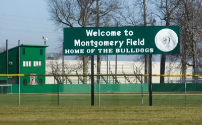
Urged by other members of the Great Lakes Summer Collegiate League, the Mariners are leaving Westview Park to play their home games at Eastview Park's Montgomery Field. [More]
Board hears from backers of girls basketball staff
FORT RECOVERY - Board of education members are still discussing whether to bring back high school girls basketball coach Doug Bihn for next year's season.
Money available for septics, farm tile control structures, silage leachate collection systems
The time frame for Grand Lake Watershed residents to apply for money to help pay to repair or replace septic systems and install farm tile control structures and silage leachate collection systems is shrinking.
ROCKFORD - Parkway school board on Tuesday learned the district was awarded a free bus.
Earlier this year superintendent Greg Puthoff applied to receive a bus Logan County no longer needed. The county could not sell the bus and a few others because they were state-owned.
The Wright State University-Lake Campus baseball team finally got its season started, losing a 7-3 decision to the University of Northwestern Ohio on Tuesday afternoon at Racer Field in Lima.
St. John's played its first regional boys basketball game since 2002 on Tuesday night and senior Curtis Geise made sure that the Blue Jays would be playing for a state tournament berth on Friday night.