Flood Advisory issued August 10 at 10:45PM EDT until August 11 at 1:45AM EDT by NWS Wilmington OH (details ...)
* WHAT...Flooding caused by excessive rainfall is expected. * WHERE...Northwestern Auglaize County in west central Ohio... Northern Mercer County in west central Ohio... * WHEN...Until 145 AM EDT. * IMPACTS...Minor flooding in low-lying and poor drainage areas. * ADDITIONAL DETAILS... - At 1045 PM EDT, radar indicated heavy rain due to thunderstorms. Minor flooding is ongoing or expected to begin shortly in the advisory area. Between 0.5 and 2 inches of rain have fallen. Additional rainfall amounts up to 2 inches are possible. - Some locations that may experience flooding include... Celina, St. Marys, Rockford, Moulton, Mendon, Buckland, Neptune, Tama, State Route 116 at State Route 197, Kossuth and Chattanooga.
Severe Thunderstorm Watch issued August 10 at 7:26PM EDT until August 11 at 2:00AM EDT by NWS Wilmington OH (details ...)
THE NATIONAL WEATHER SERVICE HAS ISSUED SEVERE THUNDERSTORM WATCH 560 IN EFFECT UNTIL 2 AM EDT TUESDAY FOR THE FOLLOWING AREAS IN INDIANA THIS WATCH INCLUDES 1 COUNTY IN EAST CENTRAL INDIANA WAYNE IN OHIO THIS WATCH INCLUDES 21 COUNTIES IN CENTRAL OHIO DELAWARE FAIRFIELD FAYETTE FRANKLIN HOCKING LICKING MADISON PICKAWAY UNION IN WEST CENTRAL OHIO AUGLAIZE CHAMPAIGN CLARK DARKE GREENE HARDIN LOGAN MERCER MIAMI MONTGOMERY PREBLE SHELBY THIS INCLUDES THE CITIES OF ADA, BEAVERCREEK, BELLEFONTAINE, CAMDEN, CELINA, CIRCLEVILLE, COLDWATER, DELAWARE, DOWNTOWN COLUMBUS, DOWNTOWN DAYTON, EATON, FAIRBORN, GREENVILLE, KENTON, KETTERING, LANCASTER, LOGAN, LONDON, MARYSVILLE, MINSTER, NEW BREMEN, NEWARK, PICKERINGTON, PIQUA, PLAIN CITY, RICHMOND, SIDNEY, SPRINGFIELD, ST. MARYS, TIPP CITY, TROY, URBANA, WAPAKONETA, WASHINGTON COURT HOUSE, WEST JEFFERSON, AND XENIA.
Flood Watch issued August 10 at 1:04PM EDT until August 12 at 8:00AM EDT by NWS Wilmington OH (details ...)
* WHAT...Flash flooding caused by excessive rainfall is possible. * WHERE...Portions of Indiana, including the following counties, Dearborn, Fayette, Franklin, Union and Wayne, Kentucky, including the following counties, Boone, Bracken, Campbell, Kenton, Lewis, Mason, Pendleton and Robertson, and Ohio, including the following counties, Adams, Auglaize, Brown, Butler, Champaign, Clark, Clermont, Clinton, Darke, Delaware, Fairfield, Fayette, Franklin, Greene, Hamilton, Hardin, Highland, Hocking, Licking, Logan, Madison, Mercer, Miami, Montgomery, Pickaway, Pike, Preble, Ross, Scioto, Shelby, Union and Warren. * WHEN...Through Wednesday morning. * IMPACTS...Excessive runoff may result in flooding of rivers, creeks, streams, and other low-lying and flood-prone locations. * ADDITIONAL DETAILS... - Several rounds of thunderstorms are expected through Tuesday night. Locally heavy rainfall can be expected with the potential for storms to repeatedly track over the same locations. This will result in the potential for flash flooding.
Flash Flood Warning issued August 10 at 11:11PM EDT until August 11 at 1:30AM EDT by NWS Wilmington OH (details ...)
At 1111 PM EDT, radar indicated thunderstorms producing heavy rain across the warned area. Between 2 and 4 inches of rain have fallen. Additional rainfall amounts up to 1 inch are possible. Flash flooding is ongoing or expected to begin shortly. HAZARD...Flash flooding caused by thunderstorms. SOURCE...Radar indicated. IMPACT...Flash flooding of small creeks and streams, urban areas, highways, streets and underpasses as well as other poor drainage and low-lying areas. Some locations that may experience flash flooding include... Bellefontaine, Kenton, West Liberty, Russells Point, De Graff, Lakeview, Waynesfield, Belle Center, West Mansfield, Chippewa Park, Northwood, Roundhead, Quincy, Mount Victory, Rushsylvania, Huntsville, Ridgeway, Valley Hi, Zanesfield and Big Springs.
Strong winds rock Grand Lake area overnight; snow, ice expected
By Shelley Grieshop
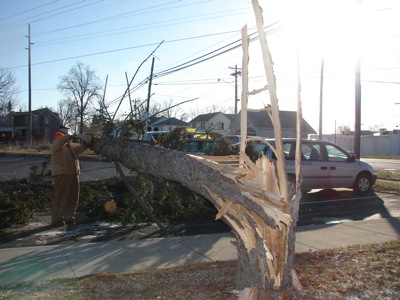
Tuesday's severe thunderstorm brought wind gusts reaching near hurricane force in portions of the Grand Lake area - but what's coming could be much worse.
A winter storm is expected to arrive Thursday night and bring up to 7 inches of snow and ice to the region through Friday. [More]
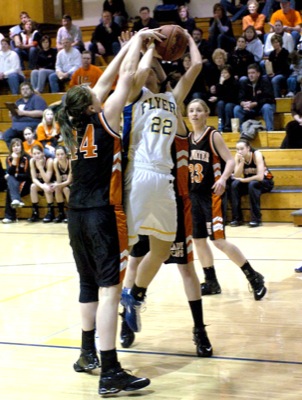
ST. HENRY - The perfect description of the play of Tuesday's Marion Local-St. Henry girls basketball game came from Flyers coach Treva Fortkamp, who said she wouldn't have used her league pass to watch the game.
Each team turned the ball over 29 times in the contest, including a combined 22 times in the fourth quarter. [More]
A class action lawsuit has been filed against Ohio Attorney General Marc Dann and sheriffs in all 88 Ohio counties on behalf of individuals whose sex offender classification status was changed by Senate Bill 10, also known as Ohio's Adam Walsh Act.
Mercer County commissioners on Tuesday approved nearly $1 million in contracts for the installation of the West Jefferson sanitary sewer system, pending the approval of a zero percent loan from the Ohio EPA.
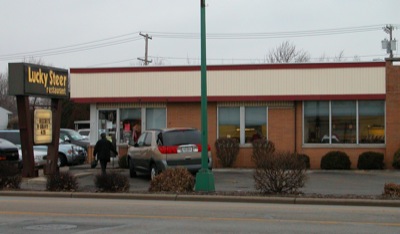
A 27-year-old St. Marys man with a long list of criminal convictions in the Grand Lake area has been charged with breaking into the Lucky Steer restaurant in St. Marys last week and stealing cash - hours after being released from the Mercer County Jail.
Celina may be in the driver's seat when it comes to the girls basketball race in the Western Buckeye League, but winning the league crown is still far from an easy task for the Bulldogs.