Extreme Heat Warning issued July 3 at 11:21AM EDT until July 3 at 8:00PM EDT by NWS Wilmington OH (details ...)
* WHAT...For the Extreme Heat Warning, dangerously hot conditions with heat index values around 105 are expected. For the Heat Advisory, heat index values around 100 are expected.
* WHERE...Portions of east central and southeast Indiana, northeast and northern Kentucky, and central, south central, southwest, and west central Ohio.
* WHEN...For the Extreme Heat Warning, until 8 PM EDT this evening. For the Heat Advisory, from 8 PM this evening to 8 PM EDT Saturday.
* IMPACTS...Heat related illnesses increase significantly during extreme heat and high humidity events, particularly for those working or participating in outdoor activities. Hot temperatures and high humidity may cause heat illnesses.
* ADDITIONAL DETAILS...Remember, multiple days with excessive heat can have compounding effects.
Heat Advisory issued July 3 at 11:21AM EDT until July 4 at 8:00PM EDT by NWS Wilmington OH (details ...)
* WHAT...For the Extreme Heat Warning, dangerously hot conditions with heat index values around 105 are expected. For the Heat Advisory, heat index values around 100 are expected.
* WHERE...Portions of east central and southeast Indiana, northeast and northern Kentucky, and central, south central, southwest, and west central Ohio.
* WHEN...For the Extreme Heat Warning, until 8 PM EDT this evening. For the Heat Advisory, from 8 PM this evening to 8 PM EDT Saturday.
* IMPACTS...Heat related illnesses increase significantly during extreme heat and high humidity events, particularly for those working or participating in outdoor activities. Hot temperatures and high humidity may cause heat illnesses.
* ADDITIONAL DETAILS...Remember, multiple days with excessive heat can have compounding effects.
Special Weather Statement issued July 3 at 7:22PM EDT by NWS Wilmington OH (details ...)
At 722 PM EDT, a strong thunderstorm was located near Wapakoneta, moving east at 45 mph.
HAZARD...Wind gusts up to 40 mph.
SOURCE...Radar indicated.
IMPACT...Gusty winds could knock down tree limbs and blow around unsecured objects.
Locations impacted include... Wapakoneta, St. Marys, Fort Shawnee, Cridersville, New Knoxville, Waynesfield, Moulton, Buckland, Uniopolis, Fryburg, Kossuth, St. Johns, and New Hampshire.
This includes I-75 in Ohio between mile markers 107 and 118.
If outdoors, consider seeking shelter inside a sturdy building.
To report hazardous weather conditions, go to our website at weather.gov/iln and submit your report via social media, when you can do so safely.
Today 93° Today 93° slight chance 75° 75° chance Tomorrow 90° Tomorrow 90° slight chance 72° 72° chance likely
Monday, September 21st, 2009
Obituaries on September 21st, 2009
Charles F. "Charlie" Barden, 44, of Uniopolis, died at 8:12 a.m. Sept. 19, 2009, at his residence. Death was due to cancer. [More]
Harold J. "Boots" Faller, 85, of Celina, died at 9:08 p.m. Sept. 20, 2009, at t [More]
Douglas Eugene Gray, 56, 113 Zillah St., Celina, died at 5:50 p.m. Sept. 17, 20 [More]
Dorothy Kahlig, 82, 5065 Gause Road, Coldwater, died at 3:12 a.m. Sept. 20, 2009, at her residence. [More]
Alvina R. Kanney, 100, of Coldwater, died Sept. 19, 2009, at Briarwood Village, Coldwater. [More]
Former Fort Recovery resident Susan K. Myers-Nearon, 63, 3630 state Route 66, H [More]
Anna L. Gehret Subler, 89, of West Water Street, Versailles, died Sept. 20, 2009, at the Versailles Health Care Center. [More]
Eddie V. Wiener, 80, 870 Hillcrest Drive, St. Marys, died at 3:57 p.m. Sept. 18, 2009, at Valley Nursing Home, St. Marys. [More]
Stories on September 21st, 2009
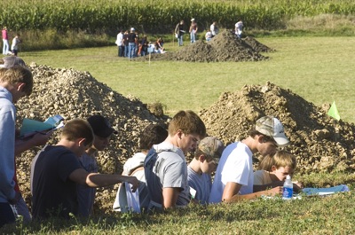
MARIA STEIN - People walking through Marion Township Park stop to admire the large circular flower bed abloom with colorful mounds of impatiens, geraniums and asters.
The death of a 25-year-old Auglaize County man who was struck by a train in Cridersville early Saturday morning has been labeled a homicide - for now [More]
Yorkshire Place Apartments manager Glen "Grinny" Fox has no intention of ever quitting work.
At 86, Fox still does all of the day-to-day operation
Four people were injured in a three-vehicle crash Sunday afternoon at the intersection of state Routes 219 and 66, south of St. Marys.
One of the i
An elderly Minster man remains in critical condition following a one-vehicle accident at 1:24 p.m. last week south of Cassella.
Richard J. Boeckman
Computer Points
There have been two trends among the local high school football conferences in recent years, and these trends are already emerging again this year.
COLDWATER - The debut season for the Coldwater girls soccer team has been one counted in miles.
Not only miles in the strides the team has made through the season, but, more to the point, miles put on the school bus traveling to matches. [More]
Compiled by Ryan Hines
and Gary R. Rasberry
A number of area teams converged at The Mercer County Elks on Saturday for the second annual Jordan
Local pictures on September 21st, 2009